June 17, 2026 · 4 min read
The question, "What is it like to hike to the summit of Mount Pinatubo today?" often conjures images of the stunning turquoise crater lake, a breathtaking reward after a challenging trek. While the summit views are undeniably iconic, the true story of Pinatubo, the one less often told, extends far beyond that famous caldera.
Hiking Pinatubo is an encounter with a landscape constantly being reshaped, a region where nature's immense power and human resilience converge. From submerged towns to half-buried churches, the journey reveals a series of unexpected wonders and vivid stories hidden in plain sight, offering a deeper understanding of this remarkable Philippine volcano.
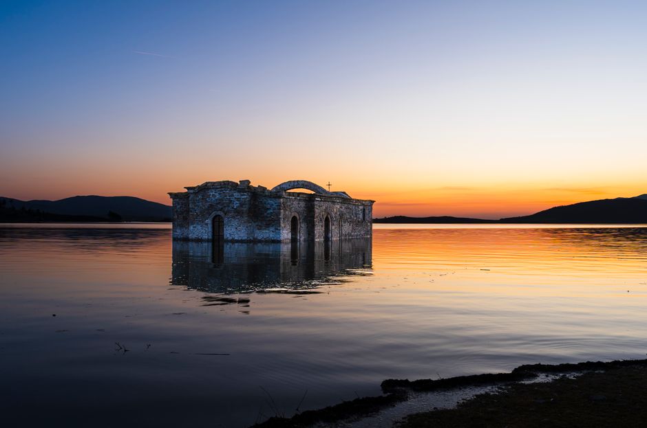
1. Mapanuepe Lake's Sunken Village
San Marcelino, Zambales, Philippines
A thriving town was completely submerged by the 1991 eruption, creating a new lake where a church steeple occasionally surfaces.
When Mount Pinatubo erupted in 1991, not all its destruction came from above. Lahar flows dammed the Marella River, forming Mapanuepe Lake. Beneath its calm surface lies the former town of San Marcelino, now a watery tomb. During dry spells, the ghostly cross of the old church steeple can still be seen, a stark reminder of the communities swallowed whole by the mountain's wrath.
2. The Half-Buried San Guillermo Parish Church
Bacolor, Pampanga, Philippines
This historic church stands defiant, half-submerged by volcanic mudflows, yet still serves its community today.
In Bacolor, just a short distance from the volcano, stands the San Guillermo Parish Church, a testament to human resilience. The 1991 eruption sent massive lahar flows cascading through the town, burying the church up to its window sills. Instead of abandoning it, the community simply dug new doors and windows at the higher level, continuing services in what became an extraordinary, subterranean sanctuary.

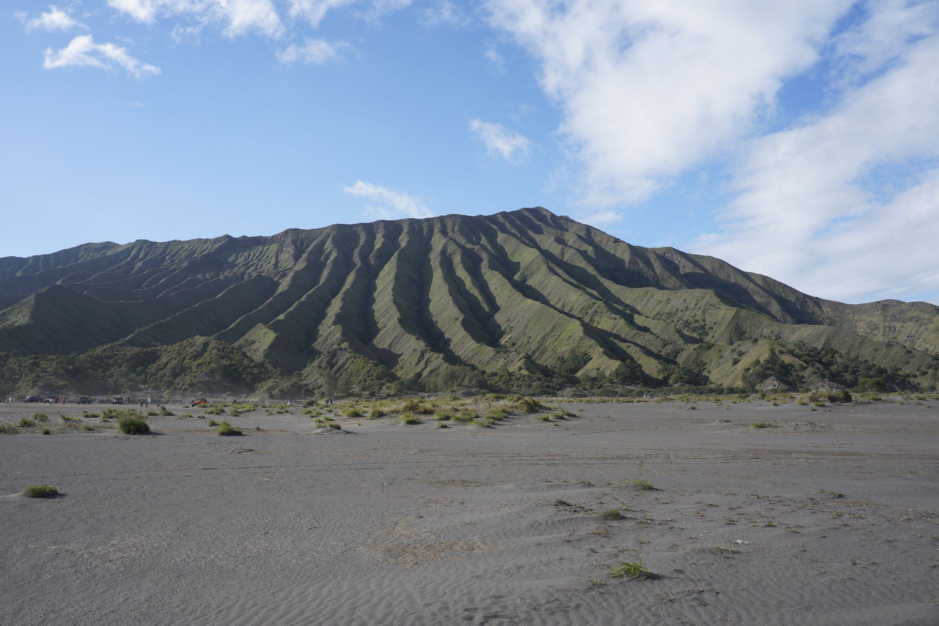
3. Crow Valley's Martian Landscape
Capas, Tarlac, Philippines
The 4x4 journey through Crow Valley reveals an otherworldly expanse of volcanic ash and rock, a landscape constantly being sculpted by nature.
The initial leg of the Pinatubo trek involves a thrilling 4x4 ride through Crow Valley, a vast expanse of lahar fields. This isn't just a dirt road; it's an ever-changing "moonscape" of grey volcanic ash, deep canyons carved by seasonal rains, and strange rock formations. The sheer scale and desolation here, where only hardy grasses and scattered bushes persist, offer a raw, humbling glimpse into the sheer power of the eruption and the slow process of ecological recovery.

4. Aeta Ancestral Resilience
Zambales Mountains, Philippines
The indigenous Aeta people, displaced by the eruption, have demonstrated remarkable resilience, returning to their ancestral lands and adapting their traditional ways of life.
The Aeta, the indigenous people of the Zambales Mountains, were profoundly impacted by the Pinatubo eruption, losing homes and ancestral hunting grounds. Yet, their deep connection to the land saw many return, adapting their traditional knowledge to the new, transformed landscape. They are keepers of ancient wisdom about the mountain, navigating its terrain and utilizing its resources in ways that predate recorded history, a living testament to their enduring spirit.
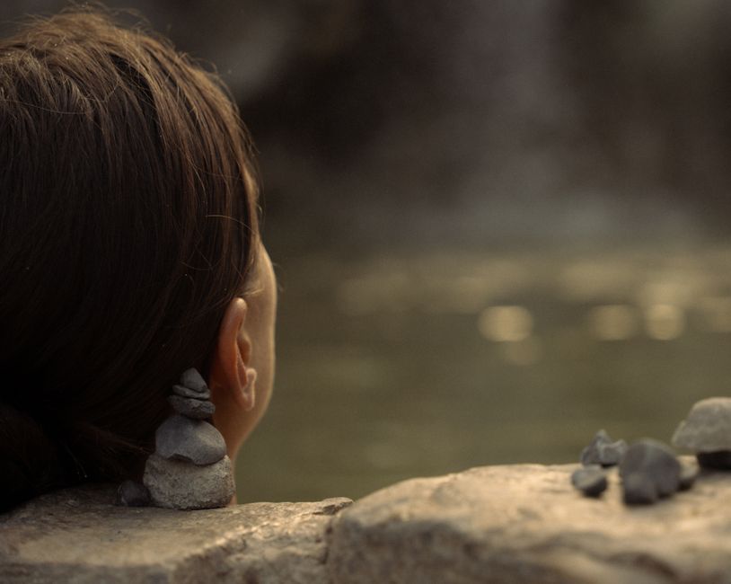
5. Puning Hot Spring & Sand Spa's Geothermal Embrace
Sapang Bato, Angeles City, Pampanga, Philippines
This unique spa experience, born from Pinatubo's geothermal activity, offers a chance to relax in naturally heated sand and volcanic mud.
After the eruption, the geothermal energy of Pinatubo found new outlets, leading to the creation of Puning Hot Spring and Sand Spa. Here, you don't just soak in water; you're buried in naturally heated volcanic sand, said to have therapeutic properties. The experience culminates with a mud pack applied using nutrient-rich volcanic soil, a direct connection to the mountain's transformative power, offering both relaxation and a unique geological encounter.
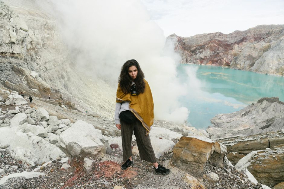
6. The Whispering Fumaroles of the Crater Rim
Mount Pinatubo Crater Rim, Philippines
Beyond the famous turquoise lake, subtle steam vents along the crater rim remind visitors that Pinatubo remains a geologically active, breathing volcano.
While the stunning turquoise crater lake is the summit's main draw, take a moment to notice the small fumaroles—steam vents—along the crater rim. These subtle plumes of steam and sulfurous gases are faint whispers from the Earth's interior, evidence of the lingering geothermal activity beneath. They serve as a quiet, powerful reminder that Mount Pinatubo is not merely a scenic viewpoint but a living, dynamic volcano, still shaping its environment.
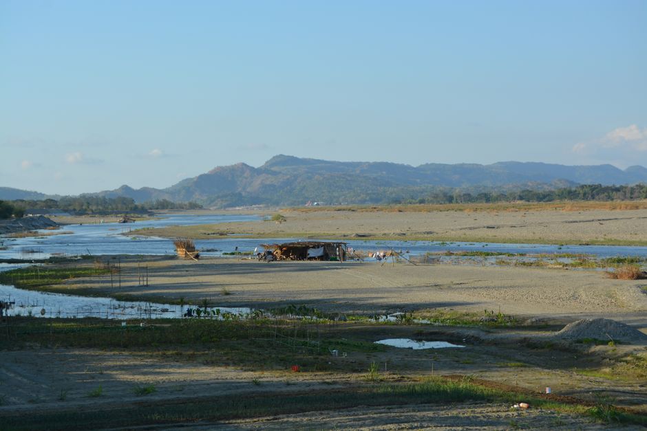
7. Sacobia River's Shifting Sands
Sacobia River, Capas, Tarlac, Philippines
The vast, active lahar plain of the Sacobia River is a powerful illustration of nature's constant reshaping, where the landscape changes with every rainy season.
As you journey towards Pinatubo, the Sacobia River's expansive lahar plain unfolds—a landscape of shifting sands and gravels. This isn't a static scene; the river, swollen by monsoon rains, continues to transport and deposit volcanic debris, constantly re-sculpting the plain. It's a living geological laboratory, demonstrating the ongoing impact of the 1991 eruption and the slow, inexorable march of erosion and deposition, creating a new ecosystem day by day.
Frequently asked questions
How difficult is the Mount Pinatubo hike?
The Mount Pinatubo hike is generally considered moderate. It involves an exhilarating 4x4 ride followed by a 1.5 to 2-hour trek over varied terrain, including river crossings and volcanic sand. While not overly strenuous, a basic level of fitness is recommended.
What is the best time of year to hike Mount Pinatubo?
The dry season, from November to May, is ideal for hiking Mount Pinatubo. The weather is more stable, and the lahar trails are less prone to flooding, ensuring safer and more comfortable trekking conditions. Avoid the peak rainy season from June to October.
Are there any safety precautions for hiking Pinatubo?
Yes, always hike with a registered guide, especially through the lahar fields. Wear appropriate footwear for uneven terrain and river crossings, bring enough water and sun protection, and be aware of weather conditions. The local tourism office provides necessary permits and guides.
How can AllTours.ai enhance my visit to Mount Pinatubo?
AllTours.ai brings the stories of Mount Pinatubo to life right on your phone. Simply point your camera at the landscape—be it the crater lake, the lahar fields, or even the half-buried church in Bacolor—and the app will narrate its fascinating history, geology, and cultural significance in your preferred language. It's like having a local expert by your side, unveiling the hidden narratives of every view.
Photography via Pexels. AllTours.ai is an AI audio tour guide — point your camera at any landscape and hear its story.