June 15, 2026 · 4 min read
Mount Pinatubo's 1991 eruption was one of the 20th century's most powerful, drastically reshaping the landscape and affecting global climate. Today, the volcano is a popular trekking destination, famous for its stunning turquoise crater lake. But for many, the journey begins and ends there, missing the deeper stories etched into the very ground you walk.
Beyond the iconic summit view, Pinatubo's surrounding areas hold tales of geological drama, human resilience, and surprising natural beauty. What is it like to hike to the summit of Mount Pinatubo today? It’s an immersive experience that reveals hidden waterfalls, ancient indigenous wisdom, and landscapes still bearing fresh scars from a monumental event.
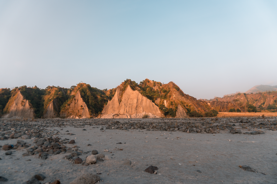
1. The Lahar Moonscape of Crow Valley
Crow Valley, Capas, Tarlac, Philippines
The vast, desolate valley you traverse wasn't always barren; it was once a fertile landscape buried by a single eruption.
The two-hour 4x4 journey to the trailhead cuts through what's known as the 'Lahar Moonscape.' This alien terrain of ash and volcanic debris is the direct aftermath of the 1991 eruption, where pyroclastic flows and subsequent lahars sculpted an entirely new world. Rivers now weave through canyons of solidified ash, revealing layers of geological history with every turn.

2. Aeta Ancestral Lands (near Santa Juliana)
Santa Juliana, Capas, Tarlac, Philippines
The Aeta people, who lived on Pinatubo's slopes for centuries, used their deep ancestral knowledge to predict the eruption and save lives.
Before the 1991 eruption, Aeta communities were forced to evacuate their ancestral homes on Mount Pinatubo's slopes. Their oral traditions and observations of the mountain's subtle changes, passed down through generations, provided crucial early warnings. Today, some Aeta communities are slowly rebuilding, offering a glimpse into a culture deeply intertwined with the volcano's rhythms and resilience.
3. Puning Hot Spring & Sand Spa
Sitio Puning, Sapang Bato, Angeles City, Pampanga, Philippines
Experience a unique spa treatment where the very ash that devastated the region is now used for therapeutic purposes.
After the hike, consider a detour to Puning Hot Spring, a facility known for its therapeutic volcanic mud and sand spas. Here, you're buried in hot volcanic sand, believed to detoxify, and then soak in naturally heated mineral waters. This isn't just a spa; it's a direct, grounding connection to Pinatubo's geothermal energy, transformed into wellness.
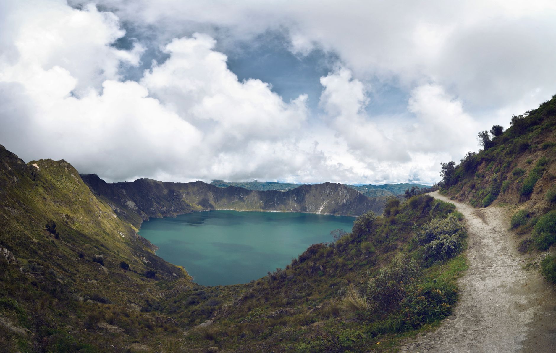
4. The Shifting Colors of Pinatubo Crater Lake
Mount Pinatubo Crater Lake, Zambales/Tarlac/Pampanga, Philippines
The stunning turquoise of Pinatubo's crater lake isn't constant; its hue subtly changes with the mineral content and sunlight throughout the day.
While the vibrant blue-green lake is the summit's main draw, few pause to observe its dynamic nature. The lake's color variations are a result of dissolved minerals from the volcanic rock and algae, constantly interacting with light. Depending on the weather and time, it can range from deep emerald to a startling azure, a living testament to the ongoing geological processes beneath.
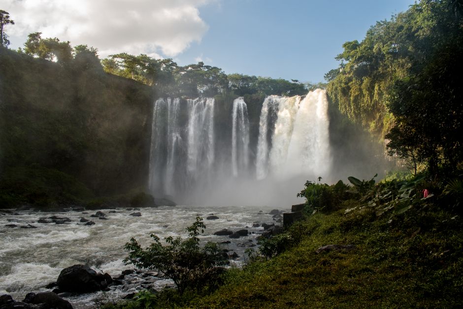
5. The 'Lost' Miyamit Falls Trail
Miyamit Falls, Capas, Tarlac, Philippines
Many hikers rush past a less-traveled fork in the path leading to a serene waterfall, often missing this tranquil reward.
Beyond the main trail to the crater, a lesser-known path veers off towards Miyamit Falls. This secluded cascade offers a refreshing break from the arid lahar landscape, a surprising oasis of cool water and lush vegetation. It's a reminder that Pinatubo's ecosystem, despite its dramatic past, harbors pockets of vibrant life away from the main tourist gaze.
6. The Buried Forest Remnants
Pinatubo Trekking Trail, Capas, Tarlac, Philippines
Along the trek, you can still spot ghost-like remnants of trees, choked and buried by the 1991 eruption's pyroclastic flows and lahars.
As you hike the final stretch towards the crater, keep an eye out for exposed tree trunks, half-submerged or encased in solidified ash and mud. These are not ancient fossils but direct witnesses to the 1991 eruption, silently testifying to the immense power that buried vast forests in minutes, preserving them in a geological time capsule.
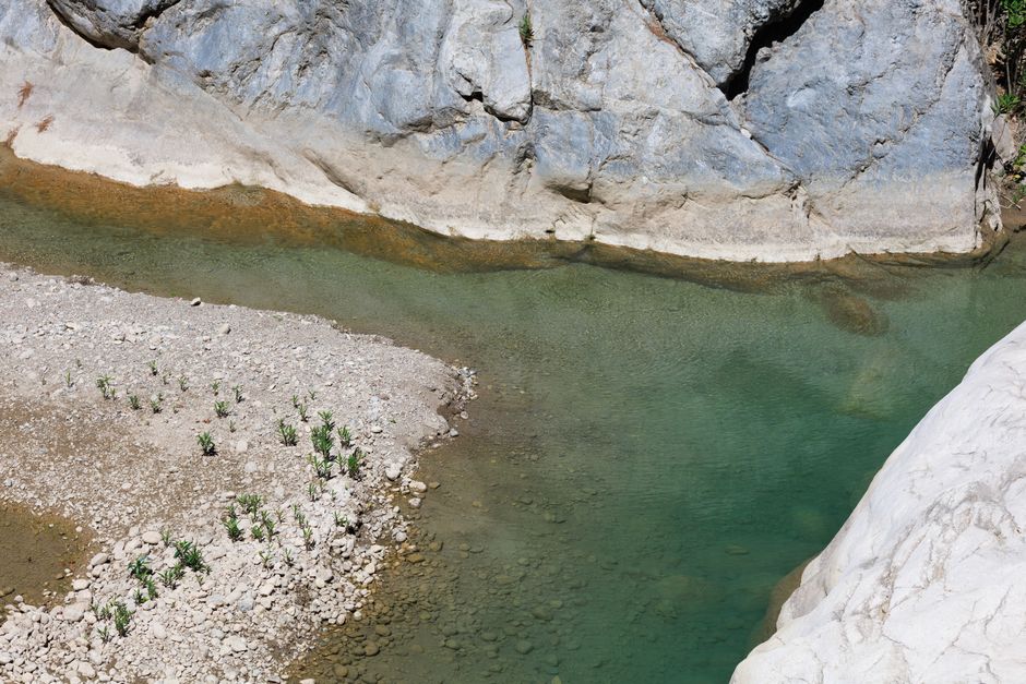
7. The Volcanic Canyons of Sacobia River
Sacobia River, Pampanga, Philippines
The Sacobia River has carved dramatic canyons through layers of volcanic debris, revealing a cross-section of Pinatubo's eruption history.
The Sacobia River, one of the primary pathways for Pinatubo's lahars, now flows through deep, intricate canyons. These natural trenches expose distinct strata of ash, pumice, and volcanic rock, each layer telling a story of past eruptions and the powerful forces that shaped this region. It's a living geology textbook, constantly being reshaped by water and time.
Frequently asked questions
Is hiking Mount Pinatubo safe today?
Yes, Mount Pinatubo is considered safe for hiking. The volcano is continuously monitored by PHIVOLCS, and tours are only permitted when conditions are stable. Local guides are mandatory, ensuring safety protocols are followed throughout the trek.
How difficult is the Mount Pinatubo hike?
The hike is generally considered moderate. It involves a two-hour 4x4 ride over rugged lahar terrain, followed by a 1.5 to 2-hour trek each way on foot to the crater. The trail is mostly flat with a final ascent, suitable for most active individuals.
What should I bring for the Pinatubo trek?
Essential items include plenty of water, snacks, sunscreen, a hat, sunglasses, comfortable trekking shoes, and a light jacket for the cooler mornings. A camera is a must for the stunning views, and a small backpack for your essentials.
How can AllTours.ai enhance my Mount Pinatubo experience?
AllTours.ai transforms your trek into an even richer exploration. Simply point your phone camera at any landmark, the vast lahar fields, or the crater lake, and the app will instantly narrate its history, geology, and cultural significance in your language, revealing stories and facts you might otherwise miss.
Photography via Pexels. AllTours.ai is an AI audio tour guide — point your camera at any landscape and hear its story.