June 20, 2026 · 4 min read
Mount Pinatubo's 1991 eruption was one of the 20th century's most powerful, forever changing the Philippine landscape. Today, the hike to its crater lake is a popular adventure, but what is it like to hike to the summit of Mount Pinatubo today beyond the well-trodden path?
The journey reveals a dynamic world, sculpted by both catastrophic force and the slow artistry of time. From ghostly submerged villages to riverbeds that constantly redraw themselves, Pinatubo's slopes hold countless untold stories for those curious enough to look closer.
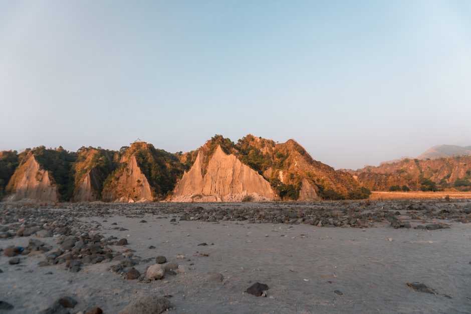
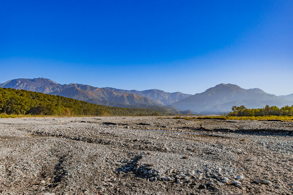
1. The Lahar Moonscape's Hidden Past
Pinatubo Crater Trail, Zambales/Tarlac, Philippines
The seemingly barren, ash-covered plains you cross were once fertile farmlands, buried under feet of volcanic debris.
As you traverse the rough terrain by 4x4, you'll enter the 'moonscape' – vast stretches of ash and sand. This otherworldly landscape isn't natural erosion; it's the aftermath of massive lahars, volcanic mudflows unleashed by the 1991 eruption. These flows buried entire communities and reshaped valleys, creating a stark, beautiful testament to nature's raw power.

2. Mapanuepe Lake's Submerged Church Spire
Mapanuepe Lake, Zambales, Philippines
Beneath the tranquil surface of Mapanuepe Lake lies an entire village, including a church steeple, swallowed by the eruption's aftermath.
Formed when lahar flows from Pinatubo blocked the Mapanuepe River, this lake slowly flooded several barangays. On clear days, the haunting tip of San Guillermo Church's bell tower can still be seen peeking above the water, a ghostly monument to a town lost to the volcano's wrath, now a silent sentinel in the new landscape.
3. The Skyway Trail's Sculpted Canyons
Pinatubo Skyway Trail, Zambales, Philippines
The dramatic canyons you traverse aren't ancient geological formations, but relatively new scars carved by subsequent typhoon rains eroding the deep ash deposits.
As you proceed along the Pinatubo trail, you'll pass through towering walls of compressed ash and sand, forming intricate canyon-like structures. These dramatic formations are a testament to ongoing erosion, showcasing how water, not just fire, continues to sculpt Pinatubo's flanks, constantly changing the journey for hikers.

4. Aeta Ancestral Lands & Resilience
Around Capas, Tarlac, Philippines
The Aeta people, indigenous to these mountains, have lived through countless eruptions, developing profound resilience and unique knowledge of the land.
Though many were displaced in 1991, Aeta communities have gradually returned to parts of their ancestral domains, adapting to the altered environment. Their deep connection to Pinatubo, understanding its moods and resources for generations, offers a glimpse into a sustainable way of life intertwined with a dynamic, powerful landscape.
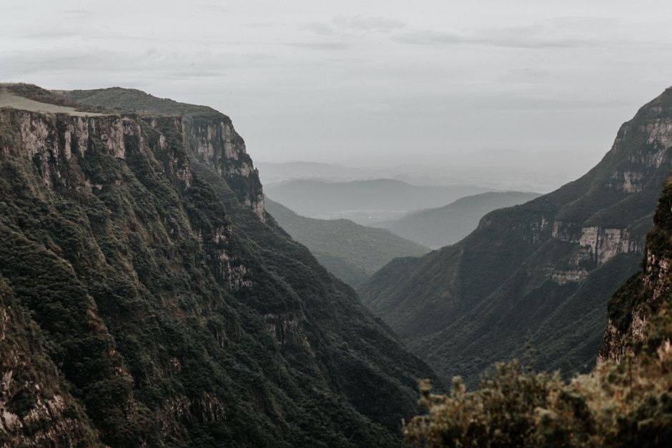
5. The Grand Canyon of Pinatubo Viewpoint
Along the 4x4 trail to Pinatubo Crater, Tarlac, Philippines
This specific viewpoint offers a panoramic glimpse into a vast basin carved by centuries of volcanic activity and erosion, long before the 1991 eruption.
While often attributed solely to the recent eruption, certain deeper, wider sections of what's called the 'Grand Canyon of Pinatubo' showcase older geological layers. Here, you can observe ancient rock formations juxtaposed with fresh lahar deposits, telling a multi-millennial story of the volcano's history and its constant reshaping of the surrounding terrain.
6. The O'Donnell River's Ever-Shifting Bed
O'Donnell River Crossing, Capas, Tarlac, Philippines
The river you ford by 4x4 isn't a static waterway, but a constantly re-engineered path, sometimes shifting course dramatically after heavy rains.
The O'Donnell River serves as a primary conduit for lahar deposits from Pinatubo's slopes. This means its bed is incredibly dynamic, shaped by every major rainfall event that sends new sediments downstream. Local guides expertly navigate these changes, a skill honed by living with the unpredictable forces of the mountain and its impact on the landscape.
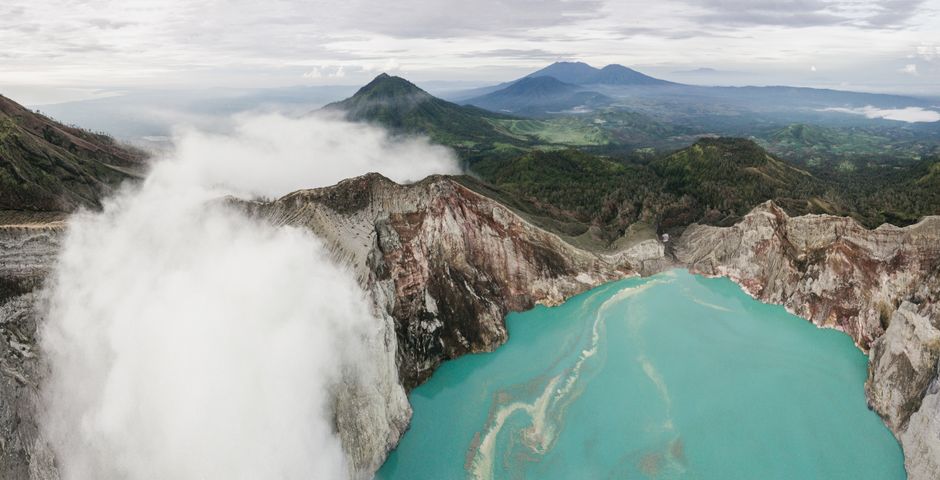
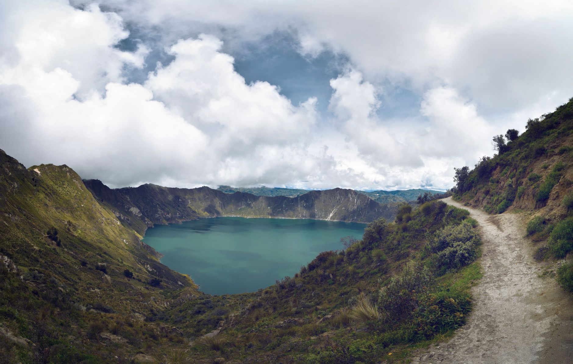
7. The Green Lake's Hidden Depths
Lake Pinatubo (Crater Lake), Zambales, Philippines
The stunning turquoise lake, the hike's ultimate reward, is not just beautiful but also remarkably deep, hiding the caldera of the 1991 eruption.
The vibrant, often emerald-hued water of Lake Pinatubo fills the massive caldera created by the 1991 eruption. Its striking color comes from the mineral-rich volcanic water. The lake's depth is significant, reaching hundreds of meters in places, a direct consequence of the massive material expulsion that created its basin, revealing the sheer scale of the geological event.
Frequently asked questions
How difficult is the hike to Mount Pinatubo?
The hike itself is generally considered moderate. The initial 4x4 ride covers rough terrain, followed by a trek that can range from 1.5 to 2.5 hours each way, depending on the trail conditions and your pace. While not technically challenging, it involves walking through sand, small river crossings, and some inclines.
What is the best time of year to visit Mount Pinatubo?
The dry season, from November to May, is generally recommended for hiking Mount Pinatubo. During these months, the weather is more stable, with less chance of rain, making the trails safer and more accessible. The peak season is typically from December to February.
Are there any safety precautions to take when hiking Pinatubo?
Yes, wear sturdy hiking shoes, bring plenty of water, sunscreen, a hat, and appropriate clothing for varying temperatures. It's crucial to follow your guide's instructions, stay on marked paths, and be aware of weather changes, as heavy rains can affect trail conditions and river crossings.
How can the AllTours.ai app enhance my Mount Pinatubo experience?
AllTours.ai transforms your hike into an immersive journey. Simply point your phone camera at a landmark, a unique rock formation, or even a distant peak, and the app will narrate its fascinating history, geological origins, and cultural significance in your preferred language. Discover hidden stories and deeper insights about the places around you, bringing the landscape to life.
Self-guided audio tours
Walk these places stop by stop — free five-stop story tours you can take at your own pace:
Photography via Pexels. AllTours.ai is an AI audio tour guide — point your camera at any landscape and hear its story.