June 19, 2026 · 4 min read
Mount Pinatubo's 1991 eruption was one of the 20th century's most powerful, forever altering landscapes and lives in central Luzon. Today, the trek to its stunning turquoise crater lake is a pilgrimage for many, a testament to nature's raw power and incredible capacity for rebirth. But what is it like to hike to the summit of Mount Pinatubo today, beyond the well-trodden paths to the iconic crater?
The journey reveals a world still actively shaped by volcanic forces and human resilience. From rivers that flow with volcanic sand to communities thriving in the shadow of a sleeping giant, Pinatubo's surrounding areas are rich with untold stories. These are the lesser-known wonders that make the Pinatubo experience truly unforgettable.
1. The Buried Bells of Bacolor
Bacolor, Pampanga, Philippines
Just miles from Pinatubo, a town's church tower still peeks out from a sea of volcanic mud, a monument to a forgotten past.
The San Guillermo Parish Church in Bacolor stands as a chilling reminder of Pinatubo's wrath. Following the 1991 eruption, years of lahar flows buried the town, submerging buildings up to their rooftops. Today, only the upper half of the church facade and its bell tower remain visible, a powerful and poignant image of destruction and the town's struggle to adapt, literally building new floors on top of buried ones.
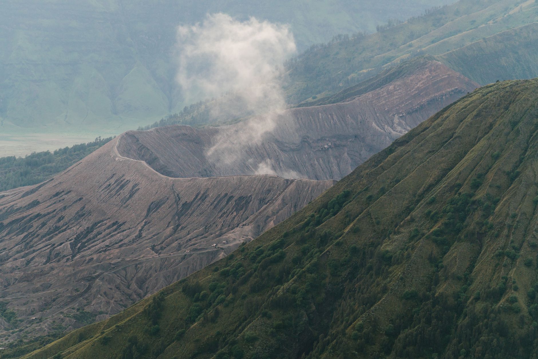
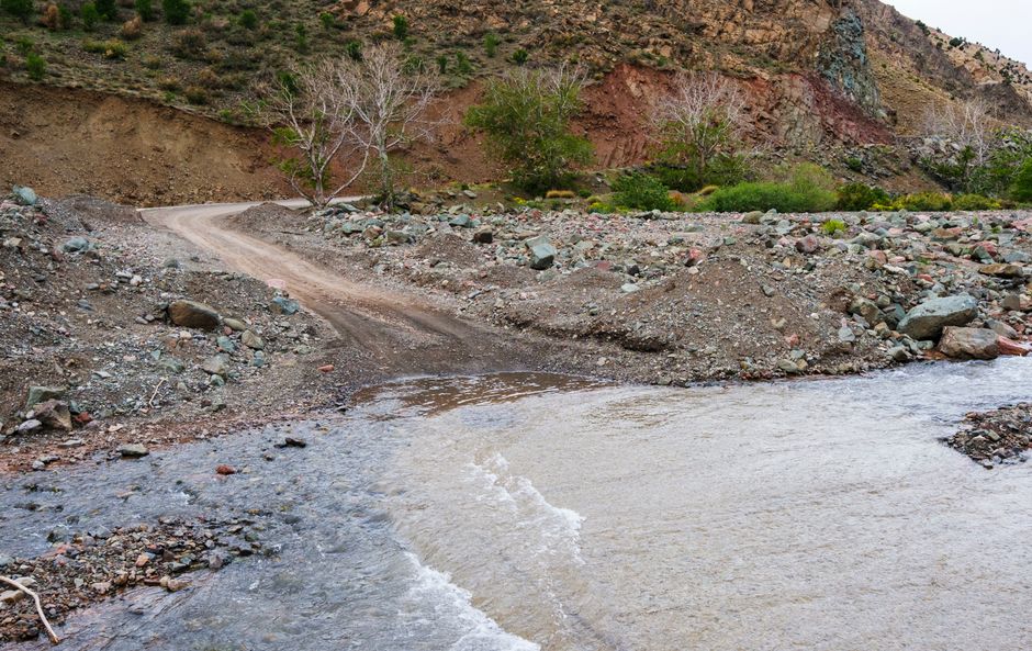
2. The Sacobia Riverbed's Shifting Moonscape
Mabalacat, Pampanga, Philippines
Venture into a vast riverbed that feels more like the surface of the moon, constantly reshaped by volcanic sediment.
The Sacobia Riverbed, a primary route for reaching the Pinatubo base camp, is an alien landscape of fine gray ash and volcanic rock. This wide, open expanse, sculpted by past lahar flows and seasonal rains, presents an ever-changing terrain. It's a stark, beautiful testament to geological forces, where new dunes form overnight and ancient river patterns are erased with each heavy downpour, making every journey unique.
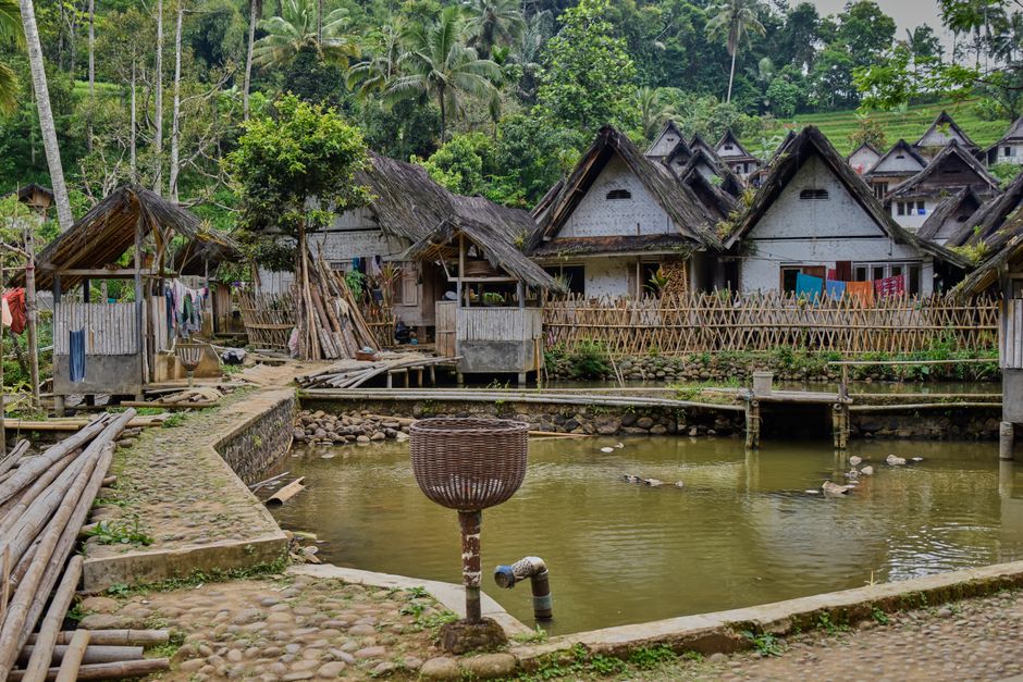
3. Sitio Tarukan's Aeta Ancestral Trail
Sitio Tarukan, Capas, Tarlac, Philippines
Discover a path through a resilient indigenous community, preserving their heritage in the shadow of the volcano.
Sitio Tarukan is one of several Aeta ancestral domains directly impacted by the eruption, yet their community has persevered. The trails here, often less traveled by mainstream tourists, offer a glimpse into the Aeta's enduring connection to the land. You might encounter local children or see traditional huts, providing a respectful insight into how the indigenous people have adapted their lives and culture to the dynamic volcanic environment.
4. Puning Hot Spring's Volcanic Sand Spa
Sitio Puning, Sapang Bato, Angeles, Pampanga, Philippines
Experience a unique geothermal spa where you're buried in warm volcanic sand, heated by the very volcano you just hiked.
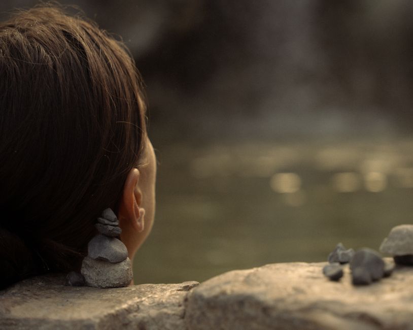
After the demanding hike, Puning Hot Spring offers a truly unique therapeutic experience. Beyond the hot springs and mud packs, the volcanic sand spa involves being buried up to your neck in warm, therapeutic sand. This practice, believed to detoxify and relax muscles, directly utilizes the geothermal heat from Pinatubo, making it an authentic and deeply relaxing connection to the mountain's ongoing geological activity.
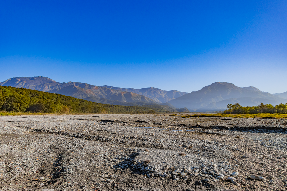
5. The Skyway to Nowhere
Crow Valley, Capas, Tarlac, Philippines
Spot remnants of a pre-eruption 'skyway' road, swallowed by lahars and now existing only as ghostly traces.
Before 1991, a high-elevation road, often called the 'Skyway,' wound through the mountainous terrain, connecting communities that no longer exist. Today, as you traverse the vast lahar plains of Crow Valley, keen eyes can sometimes spot faint, elevated sections of concrete or asphalt – ghostly reminders of this lost infrastructure. These fragments tell a silent story of a landscape utterly transformed, where roads once stood are now merely paths for river flows.
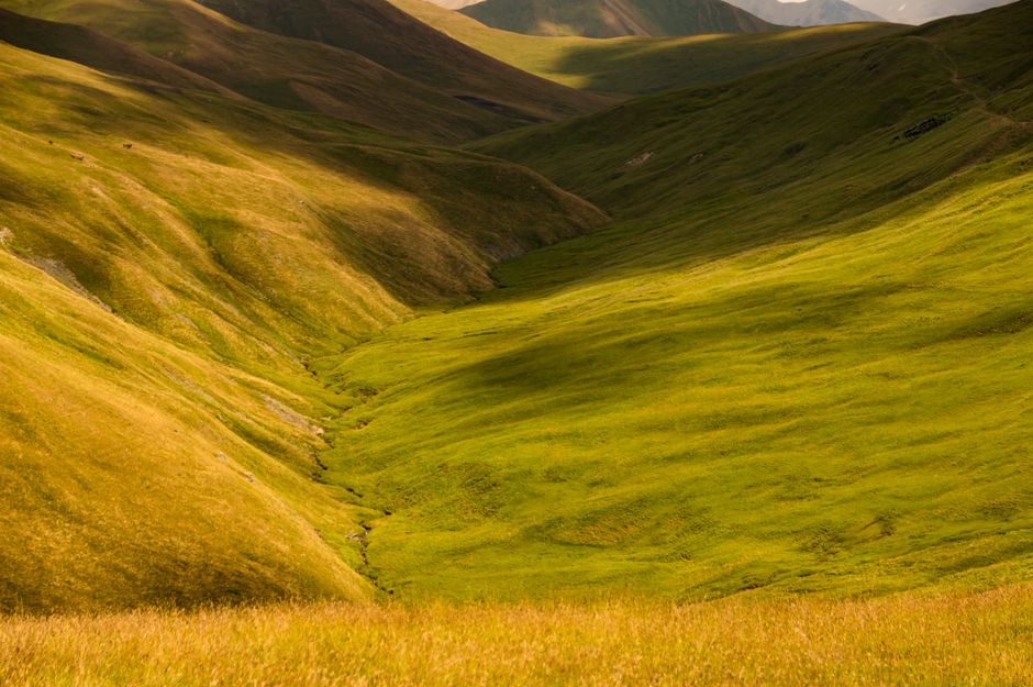
6. The Resilient Grasslands of Crow Valley
Crow Valley, Capas, Tarlac, Philippines
Witness vast expanses of vibrant grass thriving in the volcanic ash, a symbol of life's remarkable return.
While much of the lahar landscape is barren, specific sections of Crow Valley have seen an astonishing resurgence of life. Expansive grasslands, particularly hardy varieties that thrive in volcanic soil, paint swathes of green across the gray. This vibrant growth offers a stark contrast to the surrounding desolation, showcasing nature's persistent will to recover and colonize even the most challenging environments decades after the eruption.
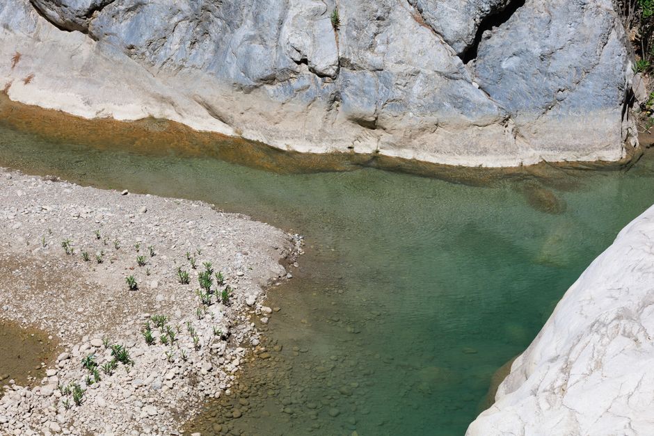
7. The Lahar-Sculpted Canyons of O'Donnell River
Capas, Tarlac, Philippines
Explore intricate canyons carved by powerful lahar flows, revealing layers of volcanic history.
The O'Donnell River, another major drainage system for Pinatubo's volcanic debris, features impressive canyons and gorges. These formations are not ancient but relatively new, carved by the post-eruption lahar flows. As you descend or ascend along certain parts of the trek, these dramatic, multi-layered cliffs of compacted ash and rock reveal the sheer force of the mudflows, offering a unique geological classroom in the open air.
Frequently asked questions
Is it safe to hike Mount Pinatubo today?
Yes, hiking Mount Pinatubo is generally safe today. The Philippine Institute of Volcanology and Seismology (PHIVOLCS) continuously monitors the volcano for activity. Trekking is only allowed when conditions are deemed safe, and local guides are mandatory, ensuring visitors follow established, secure routes.
What is the best time of year to hike Pinatubo?
The best time to hike Mount Pinatubo is during the dry season, typically from November to May. During these months, the weather is more stable, minimizing the risk of rain-induced lahar flows and making the river crossings and trails safer and more accessible.
What should I bring for the Pinatubo hike?
Pack light but essential items: plenty of water, snacks, sunscreen, a hat, sunglasses, a towel, and a change of clothes (especially if you plan to visit the hot springs). Wear comfortable trekking shoes or sandals that can get wet, as there are multiple river crossings.
How can AllTours.ai enhance my Mount Pinatubo experience?
AllTours.ai transforms your Pinatubo trek into an immersive learning journey. Simply point your phone camera at a lahar field, a resilient Aeta village, or the caldera itself, and the app will narrate its fascinating history, geological formation, and cultural significance in your preferred language, revealing stories you'd otherwise miss.
Photography via Pexels. AllTours.ai is an AI audio tour guide — point your camera at any landscape and hear its story.