June 15, 2026 · 4 min read
The question 'What is it like to hike to the summit of Mount Pinatubo today?' often conjures images of a stunning turquoise crater lake. And while that iconic view is breathtaking, the journey to reach it is just as profound, unfolding across a landscape forever scarred and reshaped by one of the 20th century's most powerful eruptions.
But beyond the widely photographed vistas, Mount Pinatubo’s slopes hold countless untold stories. From the resilient spirit of indigenous communities to unique geological formations still actively changing, the hike reveals a dynamic environment teeming with unexpected history, culture, and natural wonders if you know where to look.
1. The Buried World Beneath the Sands
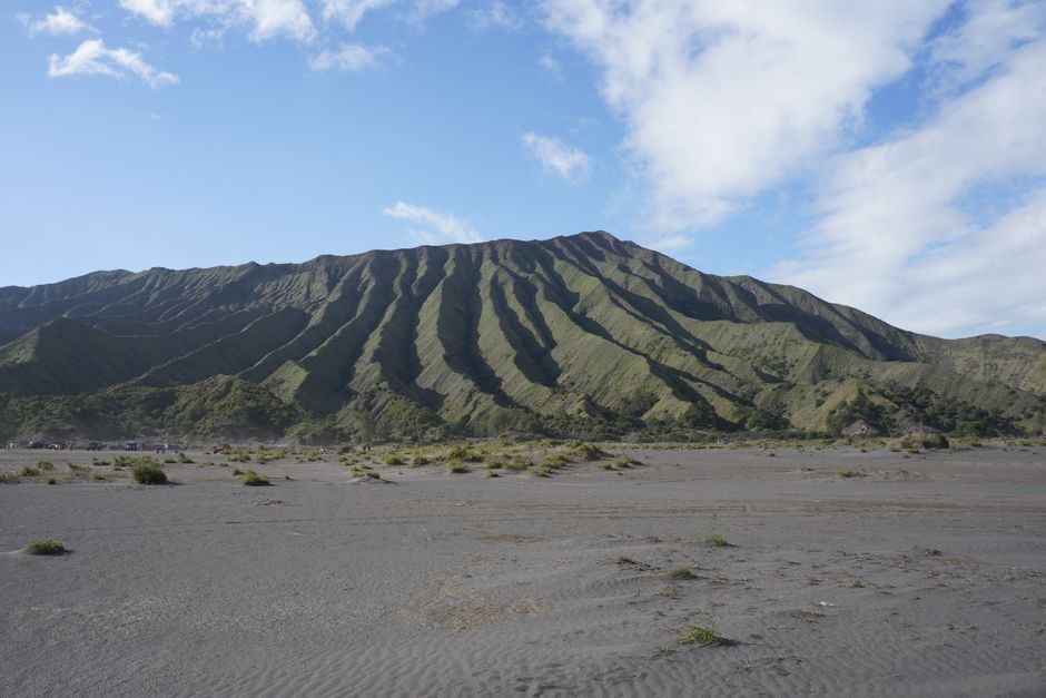
Mount Pinatubo, Philippines
Beneath the 4x4 trail's shifting sands, entire towns lie buried, swallowed by the 1991 eruption's colossal mudflows.
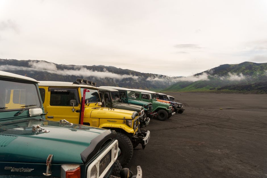
The initial 4x4 ride traverses vast, sandy riverbeds, a landscape often likened to the moon. This isn't just barren land; it's a testament to the colossal lahars that swept through after the 1991 eruption. Entire villages and agricultural fields were entombed beneath meters of volcanic debris, their memory now etched into the constantly shifting terrain, a somber reminder of nature's power.

2. Guardians of the Ash: Aeta Ancestral Lands
Mount Pinatubo, Philippines
Subtle markers along the trail signify sacred ancestral land, a testament to the indigenous Aeta people who returned after losing everything.
As you trek towards the crater, keep an eye out for small, unassuming markers or unique plant arrangements. These often denote the ancestral lands of the Aeta people, the original inhabitants of Pinatubo's slopes. Displaced en masse by the eruption, many Aeta communities have slowly returned, rebuilding their lives and preserving their deep connection to this dramatically altered, yet still sacred, landscape.
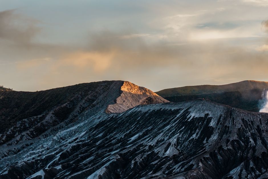
3. Sculpted Spire: Pinatubo's Geological Clock
Mount Pinatubo, Philippines
Sculpted by wind and rain, these towering ash spires are a living geological clock, revealing layers of the eruption's fallout.
Midway through the hike, the landscape shifts to reveal dramatic, naturally sculpted pinnacles of compacted ash. Each visible layer in their striations represents a different phase of the 1991 eruption, from fine ashfall to coarser pyroclastic deposits. These ephemeral structures are constantly being reshaped by the elements, a dynamic artwork of volcanic forces that continue to sculpt the land.

4. Life's Tenacity: Streams of Rebirth
Mount Pinatubo, Philippines
Amidst the ash, clear streams flow over what was once a landscape of fire, now nurturing new life and carving fresh paths.
Before the final climb to the crater rim, the trail often crosses small, surprisingly clear streams. These ephemeral waterways are crucial; they collect rainwater filtering through volcanic ash, gradually carving new channels and providing vital hydration for the hardy plants and insects that have begun to recolonize the barren landscape. They are a powerful testament to nature's relentless rebirth.
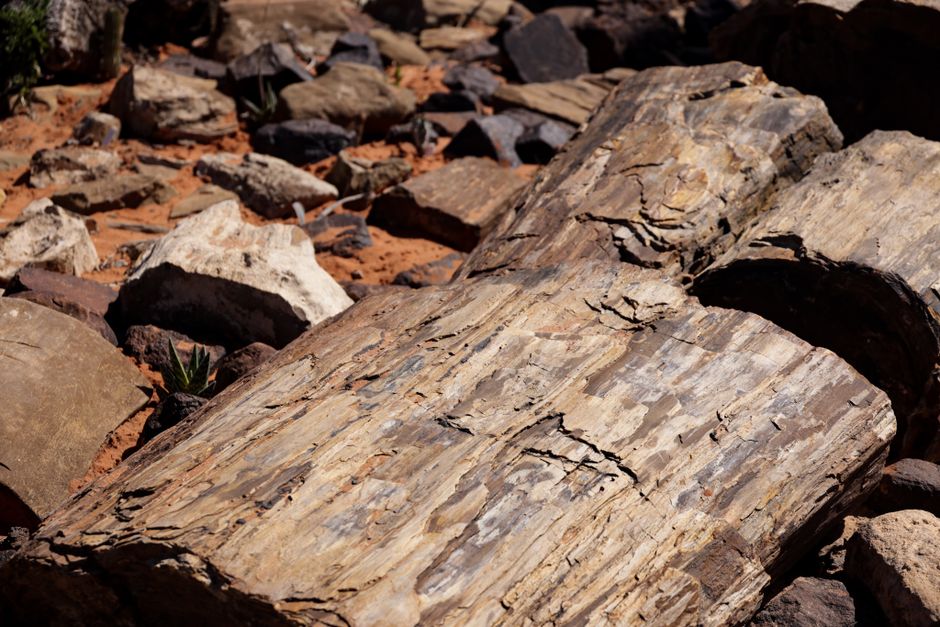
5. Echoes of a Lush Past: Petrified Forests
Mount Pinatubo, Philippines
Buried by ash for decades, fossilized tree stumps occasionally emerge, offering a silent glimpse of Pinatubo's lush, pre-eruption forests.
Keep an eye out for dark, petrified wood fragments or exposed tree stumps embedded within the compacted ash layers. These are remnants of the dense forests that once covered Pinatubo's slopes before 1991. The eruption encased them in ash, preserving a snapshot of the pre-cataclysmic ecosystem, now slowly being revealed by ongoing erosion, an eerie echo of the past.
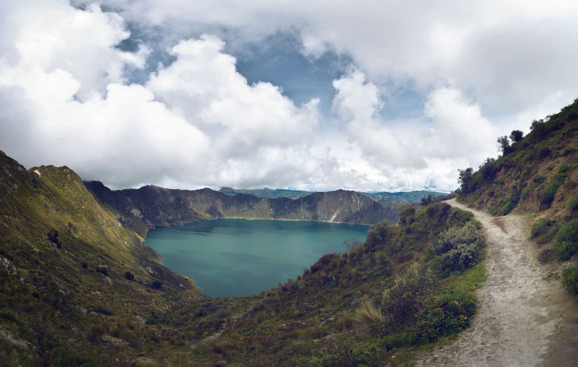
6. The Crater Lake's Chameleon Hues
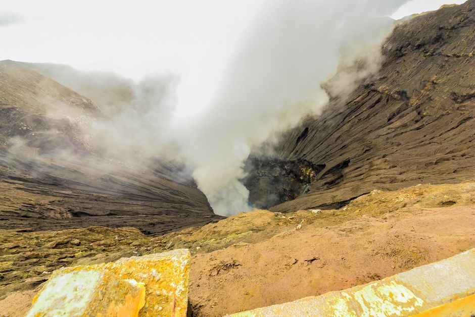
Mount Pinatubo, Philippines
The famous turquoise crater lake sometimes reveals patches of emerald green or dark sapphire blue, a dynamic canvas of mineral activity.
While the main crater lake is famed for its stunning turquoise, observe it closely from different vantage points or at various times of day. Patches of deep emerald green or even dark sapphire blue can appear. These subtle shifts are due to varying concentrations of dissolved minerals, microscopic algal blooms, and light reflection, making the lake a constantly evolving geological spectacle.
7. Ancient Projectiles: Fragments of Pinatubo's Core
Mount Pinatubo, Philippines
The massive boulders scattered along the 4x4 trail are not just rocks; they are fragments of Pinatubo's ancient core, hurled during prior eruptions.
The initial "Skyway" leading to the trek is littered with colossal boulders, some the size of small cars. Many of these aren't just ordinary rocks; they are ancient volcanic bombs and fragments of Pinatubo's pre-1991 edifice, ejected during earlier, less-known eruptions over millennia. They stand as silent sentinels, hinting at the volcano's much longer, violent history.
8. The Weeping Walls: Micro-Oases of Life
Mount Pinatubo, Philippines
Certain exposed ash walls along the trek reveal groundwater seeping through, nurturing delicate micro-ecosystems in an otherwise barren landscape.
As you approach the crater, examine the exposed, vertical ash walls. In places, groundwater slowly seeps through, creating dark streaks and allowing resilient mosses and tiny ferns to cling to the seemingly barren surface. These small, damp pockets are unexpected micro-ecosystems, showcasing life's tenacious ability to reclaim even the most extreme environments, transforming ash into a nursery.
Frequently asked questions
How difficult is the hike to Mount Pinatubo's summit?
The hike is considered moderately challenging. The initial 4x4 ride covers a significant distance, leaving a trek of about 1.5 to 2 hours each way over varied terrain, including sandy riverbeds and some uphill sections. A good level of fitness is recommended.
What is the best time of year to hike Mount Pinatubo?
The dry season, from November to May, is generally considered the best time for hiking Pinatubo. This avoids the monsoon rains, which can make the trail muddy and unsafe due to potential lahars and poor visibility.
Are there guides required for the Mount Pinatubo trek?
Yes, it is mandatory to hire a local Aeta guide and a 4x4 vehicle for the trek to Mount Pinatubo. This ensures safety, supports the indigenous community, and helps preserve the fragile environment. Guides provide valuable insights into the area's history and geology.
How can the AllTours.ai app enhance my Mount Pinatubo experience?
AllTours.ai transforms your exploration of Mount Pinatubo into an immersive experience. Simply point your phone camera at any landmark or landscape feature, and the app will instantly narrate its history, geology, and cultural significance in your preferred language, revealing stories you might otherwise miss.
Photography via Pexels. AllTours.ai is an AI audio tour guide — point your camera at any landscape and hear its story.