June 22, 2026 · 4 min read
Mount Pinatubo, a name synonymous with one of the 20th century's most powerful volcanic eruptions, is now a magnet for hikers seeking its stunning turquoise crater lake. Yet, the journey to this iconic summit offers far more than just a beautiful view.
Beyond the well-trodden paths and popular viewpoints, Pinatubo's landscape is a canvas of ongoing geological change, resilient cultures, and hidden natural wonders. Prepare to discover the lesser-known stories carved into its plains and etched into its history.
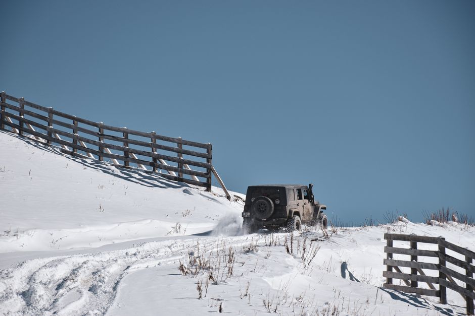
1. Crow Valley's Ancient Paths & New Riverbeds
Capas, Tarlac, Philippines
The vast, sandy expanse you traverse was once a deadly lahar flow channel that buried military history.
The journey to Pinatubo's crater often begins by crossing Crow Valley. This seemingly barren landscape was not only reshaped by the 1991 lahars but also holds historical significance, being part of the infamous Bataan Death March during WWII. The powerful volcanic mudflows of Pinatubo's eruption buried roads and rivers, creating the unique, ever-shifting sandy terrain that now serves as the main access route, a testament to both human and geological history.
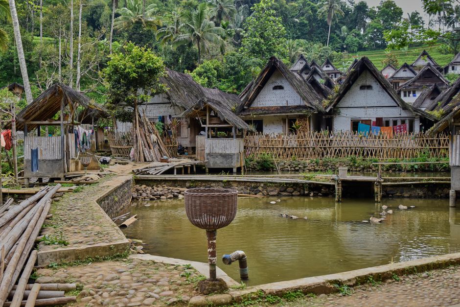
2. Aeta Ancestral Lands - A Resilient Culture
Sitio Target, Pampanga, Philippines
The indigenous Aeta people, displaced by the eruption, have returned, adapting their ancient wisdom to a new world.
Before the eruption, the slopes of Pinatubo were home to thousands of Aeta people, one of the Philippines' earliest indigenous groups. The 1991 event forced their relocation, yet many have slowly returned, rebuilding communities like Sitio Target. Their deep spiritual connection to the mountain and traditional knowledge of the land, now applied to a post-volcanic landscape, offers a profound perspective on resilience and cultural survival.
3. The Moonscape's Dynamic Canvas
Pinatubo Trekking Trail, Zambales, Philippines
The seemingly static volcanic plains you hike across are a constantly evolving geological artwork, sculpted by water.
As you trek across the open plains leading to the crater, often called the 'Moonscape,' you're walking on layers of ash and pumice from the 1991 eruption. This landscape is far from static; every rainy season, torrents of water carve new channels and reshape existing ones, creating intricate patterns of erosion. It’s a live geological exhibit, where the destructive power of the volcano continues to sculpt the land in subtle, ongoing ways.
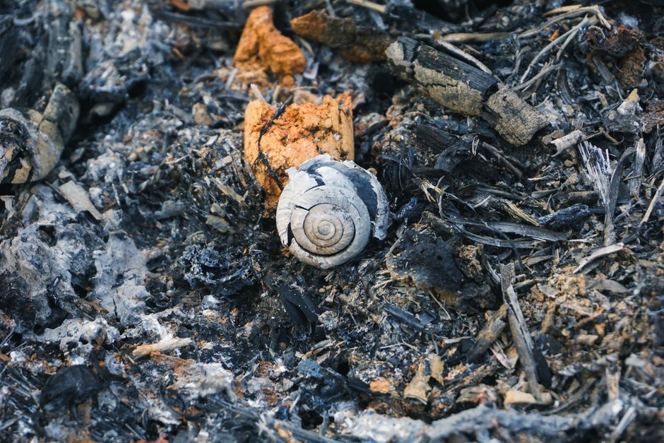
4. Pockets of Pre-Eruption Life
Hidden Ravines near Pinatubo Crater, Philippines
In sheltered gullies, you might spot rare, tenacious plant life that survived the 1991 eruption's fury.
While the eruption devastated much of the surrounding ecosystem, certain deep ravines and shielded areas miraculously escaped the full impact of pyroclastic flows and lahars. Here, isolated pockets of older, pre-1991 vegetation cling to life. Discovering these resilient trees and plants offers a poignant glimpse into the mountain's former biodiversity and the incredible tenacity of nature to reclaim and endure.
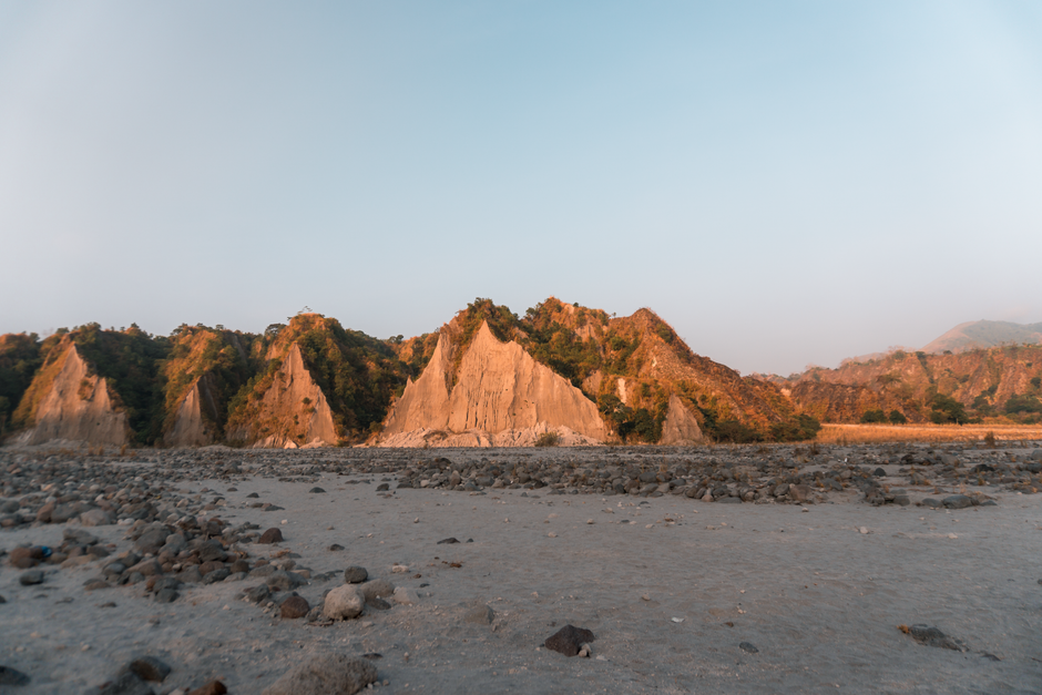
5. Eroded Pinnacles - Nature's Sculptures
Lower Lahar Plains, Pinatubo Region, Philippines
Wind and rain have carved the volcanic ash into bizarre, almost alien rock formations, revealing layers of history.
In the lower reaches of the lahar plains, the soft volcanic deposits have been sculpted by relentless erosion into intricate pinnacles, gullies, and miniature canyons, often referred to as 'badlands.' These natural sculptures are a testament to the combined forces of volcanic deposition and subsequent weathering, showcasing the diverse textures and colors of the ash and pumice layers laid down decades ago.
6. Pasig-Potrero River's Transformed Course
Pasig-Potrero River, Pampanga, Philippines
The eruption didn't just affect the mountain; it dramatically rerouted major rivers, creating new deltas downstream.
The Pasig-Potrero River, a significant waterway in Pampanga, was irrevocably altered by the 1991 eruption. Massive volumes of lahar debris choked and diverted its course, leading to widespread flooding and the formation of new, expansive deltaic plains. This transformation illustrates how the mountain's eruption had far-reaching geographical consequences, forever reshaping the hydrological network of the surrounding lowlands.
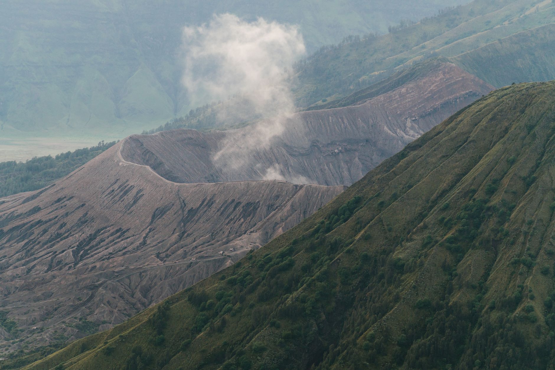
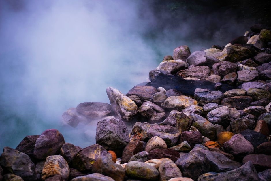
7. Sulfur Vents - Pinatubo's Sleeping Breath
Crater Lake Rim, Mount Pinatubo, Philippines
Faint wisps of steam and the subtle scent of sulfur remind you that the volcano is merely dormant, not dead.
While the vivid turquoise lake dominates the view, a keen observer might notice subtle signs of Pinatubo's continued geothermal activity near the crater rim. Small, almost imperceptible vents release faint steam, and a distinct sulfuric odor occasionally drifts on the wind. These unassuming phenomena are quiet reminders that the powerful geological forces which shaped this iconic landscape are still very much alive beneath the surface.
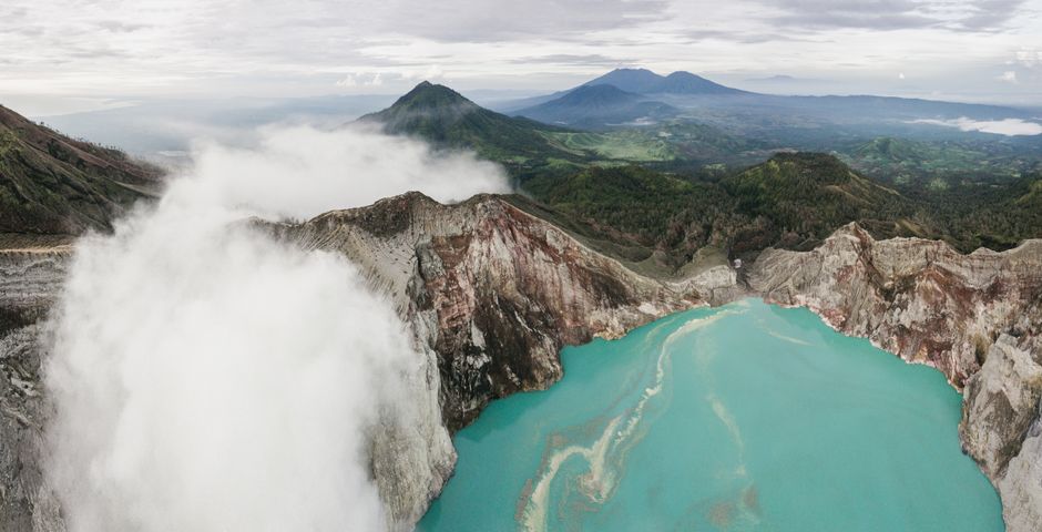
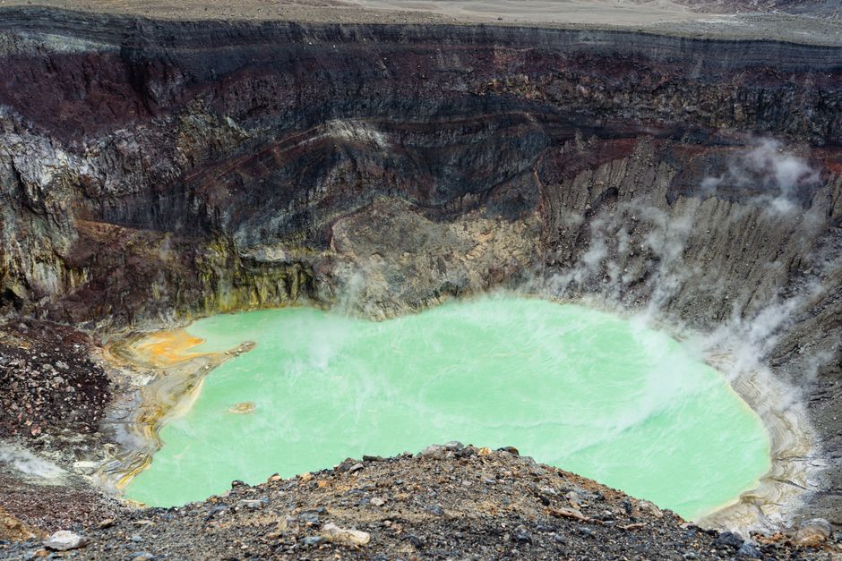
8. The Crater Lake's Shifting Hues
Pinatubo Crater Lake, Philippines
The iconic turquoise lake isn't static; its vibrant colors subtly shift with mineral content and the sun's angle.
While famous for its stunning turquoise, Pinatubo's crater lake is a dynamic body of water whose hues can change throughout the day and year. Varying concentrations of minerals, light conditions, and even microscopic algal blooms can cause its surface to appear emerald green, deeper blue, or a milky aquamarine. This constant, subtle transformation reflects the ongoing chemical and biological processes within the caldera, offering a unique viewing experience each visit.
Frequently asked questions
Is it safe to hike Mount Pinatubo today?
Yes, hiking Mount Pinatubo is generally safe today. The volcano is continuously monitored by PHIVOLCS, and authorities only permit treks when conditions are stable. Local guides are mandatory, ensuring visitors follow safe routes through the lahar landscape and to the crater.
How long does the Mount Pinatubo hike take?
The entire trip, including the 4x4 ride across the lahar plains and the trek to the crater, typically takes a full day. The 4x4 ride is about 1.5-2 hours each way, followed by a hike of 1.5-2 hours each way, depending on your pace and the specific starting point.
What's the best time of year to visit Mount Pinatubo?
The dry season, from November to May, is generally considered the best time to visit Mount Pinatubo. During these months, the weather is more stable, reducing the risk of rain-induced lahars and making the trek more comfortable. Avoid the peak rainy season (June to October) as trails can become impassable.
How can AllTours.ai enhance my Mount Pinatubo experience?
AllTours.ai turns your phone into an AI audio tour guide. As you hike through the lahar landscapes or gaze at the crater lake, simply point your camera at what you see. The app will narrate the specific history, geology, and culture of that very spot, revealing fascinating stories and facts you might otherwise miss.
Photography via Pexels. AllTours.ai is an AI audio tour guide — point your camera at any landscape and hear its story.