June 20, 2026 · 4 min read
When Mount Pinatubo erupted in 1991, it became one of the 20th century's most powerful volcanic events, forever changing the landscape of Luzon, Philippines. Today, the hike to its summit is famed for the stunning turquoise crater lake that occupies the heart of its newly formed caldera, drawing adventurers eager to witness nature's dramatic resurgence.
But what is it like to hike to the summit of Mount Pinatubo today, beyond the iconic viewpoint? The journey itself is a living geology lesson and a testament to resilience, revealing surprising stories woven into the ash and rock. From landscapes shaped by unimaginable forces to the quiet adaptations of indigenous communities, the path to Pinatubo's summit offers far more than just a beautiful vista.
1. The River of Buried Valleys
Sacobia River Bed, Pampanga, Philippines
The sandy highway you traverse was once a lush valley, buried deep by volcanic flows.
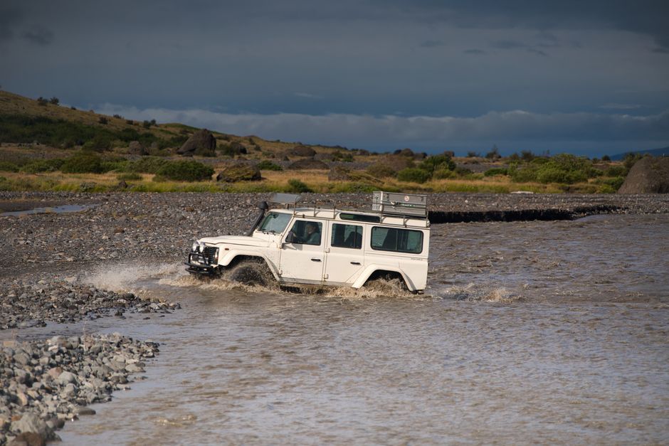
The initial 4x4 ride takes you across the vast, sandy expanse of the Sacobia River bed. This isn't just a river; it's a testament to the colossal power of the 1991 eruption. Hundreds of feet of pyroclastic flows and subsequent lahar—a dense mix of ash, rocks, and water—engulfed and reshaped entire valleys here, creating an otherworldly, desolate yet awe-inspiring landscape that continues to erode and change with every monsoon season.

2. Echoes of Ancestral Lands
Aeta resettlement areas (e.g., Sitio Target), Pampanga, Philippines
Indigenous communities here show profound resilience, even using volcanic ash to create art.
Along the lower reaches of the trail, you might pass through areas where the Aeta people, the indigenous inhabitants of the region, have re-established their lives. Displaced by the eruption, many have returned, demonstrating remarkable adaptation. Some Aeta artisans even incorporate volcanic ash into their traditional crafts, transforming the very material that devastated their homes into a medium for cultural expression.
3. Sculpted Canyons of Ash
Pinatubo Ash Canyons, Pampanga, Philippines
The deep gullies you walk through are newly formed, carved entirely by post-eruption erosion.
After leaving the 4x4, the hike leads you into a labyrinth of deep, sculpted canyons. These dramatic formations are not ancient geological features but relatively new, carved by decades of rainfall eroding the thick layers of volcanic ash and pyroclastic deposits. Walking through these towering, temporary walls of compacted ash feels like navigating a giant, ever-changing natural sculpture, revealing the ongoing transformation of the landscape.

4. The Green Pioneers
Isolated ravines on Pinatubo slopes, Pampanga, Philippines
Amidst the barren ash, look for resilient plants that are slowly reclaiming the slopes.
While the immediate summit areas remain largely barren, keen eyes will spot pockets of vibrant green in protected ravines and on lower, more stable slopes. These pioneering plants, often grasses, ferns, and hardy shrubs, are the first wave of ecological recovery. They represent the slow, persistent return of life to a landscape once sterilized by extreme heat and covered in meters of ash, hinting at the lush forests that will one day return.
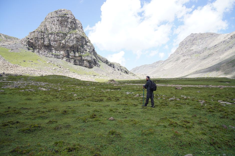
5. The False Summit's Distant Past
Mid-trail ridge viewpoint, Pampanga, Philippines
A specific ridge offers a rare glimpse into the region's pre-eruption mountain ranges.
As you ascend towards the main crater, there's often a prominent ridge that offers a different perspective than just the immediate goal. From here, on a clear day, you can see beyond Pinatubo's new contours to the distant Zambales Mountain Range. This vista allows for a mental reconstruction of the region as it was for millennia—a verdant chain of peaks, before Pinatubo dramatically altered its own summit and the surrounding topography.
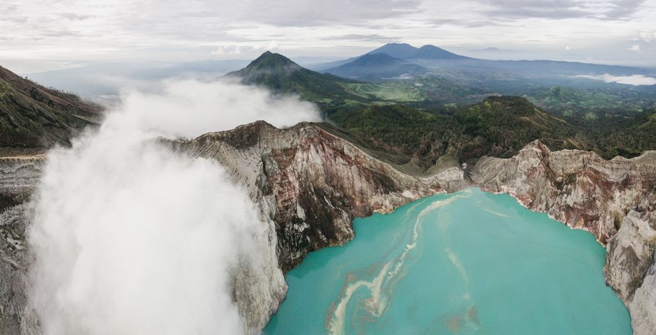
6. The Lake's Alchemical Transformation
Mount Pinatubo Crater Lake, Pampanga, Philippines
The serene turquoise lake was once as acidic as battery acid, deadly to any life.
The famous turquoise crater lake, while breathtaking today, began its life as a highly acidic body of water, with a pH so low it was comparable to battery acid, rendering it utterly inhospitable. Over the decades, relentless rainfall and natural processes have gradually diluted its chemical composition, slowly transforming it into the relatively neutral, vibrant aquatic ecosystem that now mesmerizes visitors.
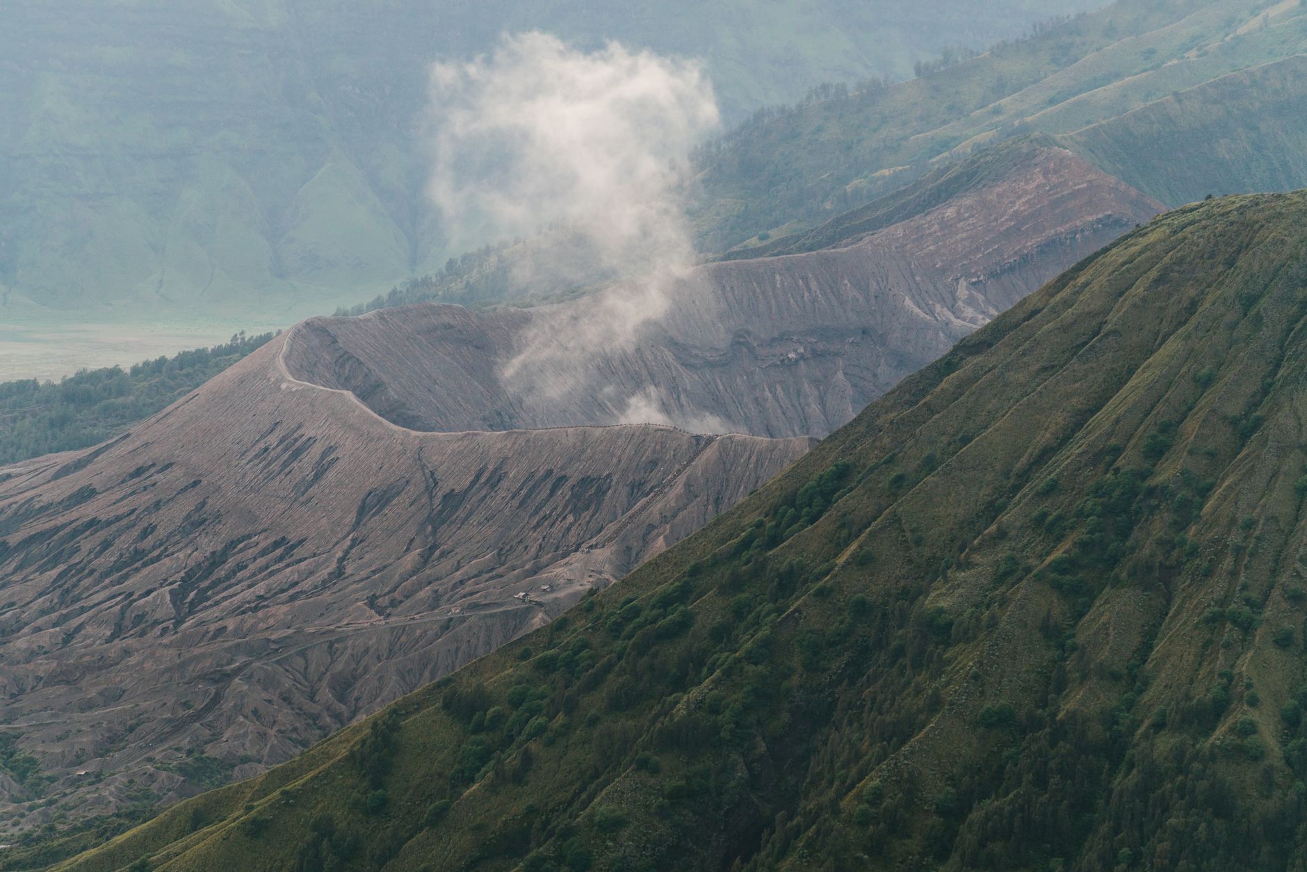
7. Caldera's Embrace
Pinatubo Crater Rim, Pampanga, Philippines
You stand not on a peak, but the rim of a massive collapsed chamber, evidence of a colossal eruption.
Reaching the "summit" means standing on the rim of a vast caldera, a basin-shaped depression formed when the volcano's magma chamber emptied and the peak collapsed inwards after the 1991 eruption. The rugged peaks surrounding the lake are not new formations, but the fractured remnants of the original, much larger Mount Pinatubo, offering a dramatic geological cross-section of its violent past.
8. The Quiet Resilience of Water
Pinatubo stream crossings, Pampanga, Philippines
Water, the same force that brought destruction, is now the silent sculptor of recovery.
Throughout the hike, you'll encounter numerous small streams and rivulets, often requiring crossings. These seemingly innocuous waterways are crucial to the landscape's ongoing evolution. They're not just remnants of rain; they're actively eroding the vast ash deposits, carving new channels, and carrying nutrients, slowly transforming the barren terrain into fertile ground, a testament to water's dual role in both destruction and regeneration.
Frequently asked questions
Is hiking Mount Pinatubo difficult, and how long does it take?
The hike to Mount Pinatubo's crater lake is generally considered moderately challenging. The 4x4 ride takes about 1-1.5 hours each way, followed by a trek of approximately 1.5-2 hours one way, depending on your pace. The trail involves walking across varied terrain, including sandy riverbeds and ash-covered hills with some uphill sections, but it's manageable for most fitness levels.
What is the best time of year to hike Mount Pinatubo?
The dry season, from November to May, is generally the best time to hike Mount Pinatubo. During these months, the weather is more stable, with less chance of rain, making the trails safer and more accessible. Avoid the peak rainy season (June to October) when heavy rains can cause lahar flows and trail closures.
Do I need a guide or can I hike Pinatubo independently?
Hiking Mount Pinatubo requires joining an organized tour, which includes a local guide and a 4x4 vehicle. Independent trekking is not permitted due to safety regulations and the need for permits to cross ancestral domains and navigate the ever-changing lahar landscape. Tour operators ensure proper coordination and safety for all visitors.
How can AllTours.ai enhance my Mount Pinatubo experience?
AllTours.ai transforms your hike into an immersive journey. As you point your phone camera at the volcanic peaks, ash canyons, or the crater lake, the app narrates their specific history, geology, and cultural significance in your language. It reveals the untold stories of Pinatubo, bringing the landscape to life with facts about its eruption, recovery, and the resilience of its people.
Photography via Pexels. AllTours.ai is an AI audio tour guide — point your camera at any landscape and hear its story.