June 20, 2026 · 4 min read
Driving the 401 between Montreal and Toronto, you might notice something striking: a distinct absence of sprawling metropolises. While you pass through charming towns and significant geographical features, the rapid-fire succession of major urban centers seen in other corridors seems to vanish. It's a question many travelers ponder: what are some possible explanations for why there are no cities dominating this crucial stretch of Canada's busiest highway?
The answer isn't a simple oversight. It's a fascinating blend of geology, early colonial decisions, Indigenous presence, and 20th-century engineering projects. To truly understand this landscape, we need to look beyond the highway itself and delve into the unique stories of the places that shaped—and were shaped by—this less-traveled corridor. Here are some of the unexpected reasons why this stretch of the 401 tells a different story of development.

1. Where Towns Disappeared Beneath the Waves
Long Sault, Ontario, Canada
Nine entire communities were submerged in the 1950s to create the St. Lawrence Seaway, profoundly altering settlement patterns.
In the mid-20th century, the ambitious St. Lawrence Seaway and Power Project forever changed this stretch of the river. To make way for the massive hydroelectric dams and shipping channel, residents of nine villages were forced to relocate, their homes, farms, and histories either moved or left to be swallowed by the rising waters. The Lost Villages Museum preserves structures saved from this monumental project, offering a tangible explanation for the relative absence of large urban centers along this historically significant corridor.
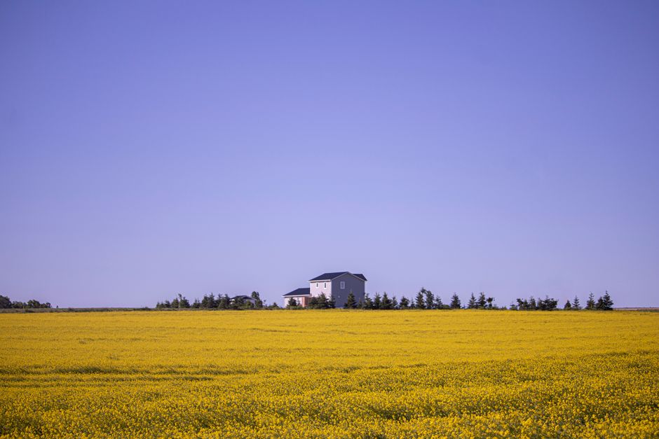
2. The Peninsula That Stayed Rural
Prince Edward County, Ontario, Canada
This distinctive peninsula, shaped by ancient glaciers, became a thriving agricultural hub but remained largely bypassed by the industrial forces that built major cities.
Prince Edward County, often affectionately called 'The County,' is a unique landform almost entirely surrounded by the waters of Lake Ontario and the Bay of Quinte. Its fertile soil attracted United Empire Loyalists in the late 18th century, leading to a robust farming and canning industry. However, its peninsular geography meant that major rail lines and later, the 401, generally hugged the mainland. This relative isolation preserved its rural charm, preventing the kind of rapid industrialization and urban expansion seen in more directly connected areas.

3. An Enduring Indigenous Landscape
Tyendinaga Mohawk Territory, Ontario, Canada
This extensive Indigenous territory represents a continuous Mohawk presence, predating and existing outside the colonial urban planning that shaped surrounding regions.
Spanning a significant portion of the landscape along the 401 corridor, Tyendinaga Mohawk Territory is one of Canada's largest First Nations reserves. Granted to the Mohawks of the Bay of Quinte for their loyalty to the British Crown, its lands have been continuously occupied by the Mohawks for centuries. Its status as an autonomous territory means its development has followed different patterns than surrounding municipalities, preserving a unique cultural landscape and explaining why this substantial area is not punctuated by large, non-Indigenous cities.
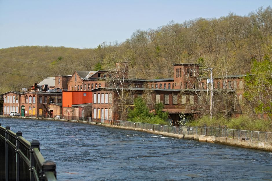
4. Napanee's Unfulfilled Urban Promise
Napanee, Ontario, Canada
Once a bustling industrial center powered by its river, Napanee's growth was eventually capped by the dominance of larger regional hubs and shifting economic tides.
The Napanee River, cascading through the town into the Bay of Quinte, provided crucial water power for early mills and factories, making Napanee a significant industrial player in the 19th century. There was a time it rivaled Kingston in its economic aspirations. However, as rail and road networks prioritized other routes and industries centralized in larger cities, Napanee settled into a role as a vibrant market town. Its historic downtown and well-preserved architecture offer a glimpse into a past where it almost became a larger urban center.

5. Where Military Might Shaped a Town
Quinte West, Ontario, Canada
The establishment of Canada's largest air force base created a distinct population hub whose growth was driven by defense rather than traditional industrial expansion.
CFB Trenton, a cornerstone of Canadian defense since 1931, dramatically shaped the development of the surrounding municipality of Quinte West. As the primary air mobility hub for the Canadian Armed Forces, it brought a substantial military and civilian population to the area. This growth pattern is distinct from the typical industrial or commercial drivers of city development. Quinte West, therefore, represents a significant concentration of people along the 401, but one whose character and origins are intrinsically tied to its strategic military importance.
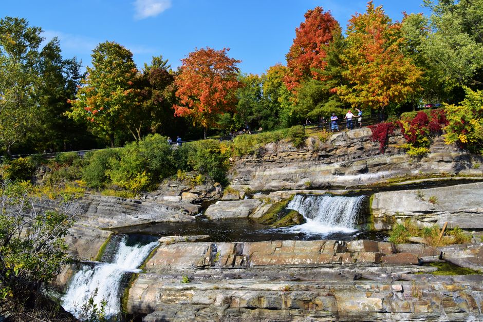
6. The Canal That Diverted Destiny
Jones Falls, Ontario, Canada
This engineering marvel, completed in the 1830s, created an inland transportation route that redirected early settlement and economic development away from the immediate St. Lawrence corridor.
The Rideau Canal, a UNESCO World Heritage site, was built to provide a secure military and commercial route between Kingston and Ottawa, bypassing the vulnerable St. Lawrence River. Its construction fostered inland communities and trade, drawing significant early population and industrial growth away from the direct riverfront. Sites like the impressive stone locks at Jones Falls illustrate the scale of this project, revealing how a strategic decision nearly two centuries ago influenced where cities didn't grow along what would become the 401.
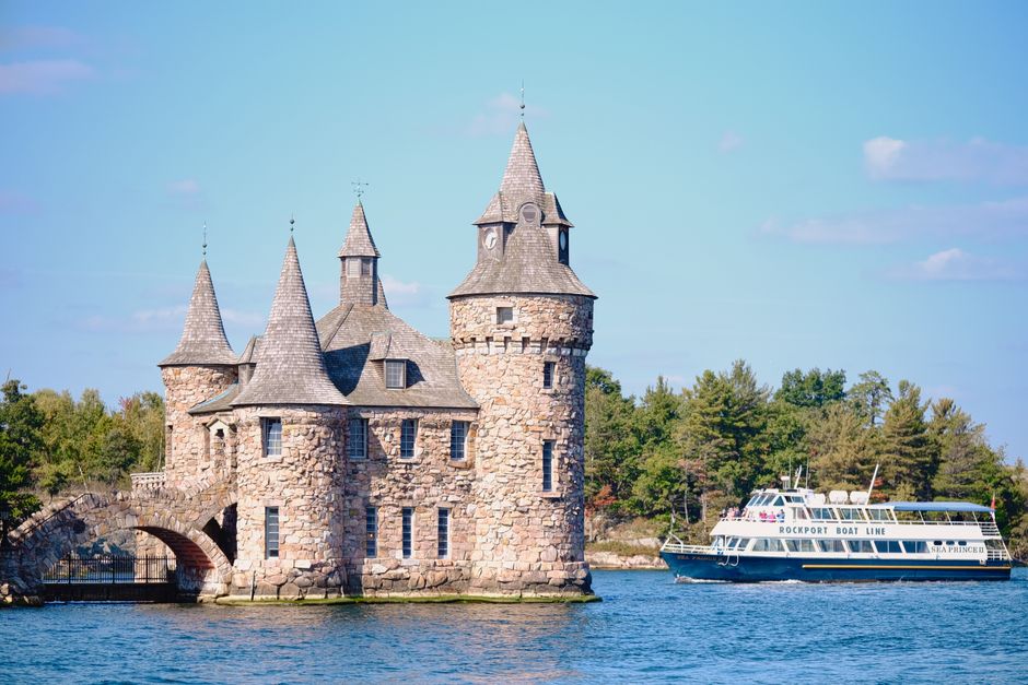
7. A Landscape Preserved by Design
Mallorytown Landing, Ontario, Canada
Designated as a national park, large sections of the Thousand Islands archipelago are preserved for their natural beauty, preventing widespread urban development.
The stunning Thousand Islands region, where the St. Lawrence River breaks into a labyrinth of islands, is partly protected as Thousand Islands National Park. This designation ensures the preservation of its unique granite and pine ecosystems, limiting the potential for urban sprawl. While popular for tourism, the park's existence emphasizes conservation over development, naturally creating a less densely populated stretch along the 401. The choice to preserve this natural wonder directly impacts why cities don't dominate this picturesque corridor.
Frequently asked questions
Why is Highway 401 often called "The Macdonald-Cartier Freeway"?
Named after two of Canada's Fathers of Confederation, Sir John A. Macdonald and Sir George-Étienne Cartier, the highway symbolizes the unity and connection between English and French Canada. This name reflects its role as a vital artery linking Ontario and Quebec.
Are there any significant natural features that explain the lack of cities along the 401?
Yes, the eastern part of the 401 corridor borders the Canadian Shield, which is less fertile and harder to develop than the Great Lakes Lowlands. Additionally, the St. Lawrence River's broad sections and numerous islands, particularly in the Thousand Islands region, lend themselves more to natural preservation than large-scale urban expansion.
What role did early transportation routes play in where cities developed?
Before the 401, major transportation focused on the St. Lawrence River and later, railways. Cities naturally grew at strategic points along these routes. The Rideau Canal, for example, diverted some early settlement inland, meaning the immediate corridor where the 401 now runs wasn't always the primary focus for large urban centers.
How can AllTours.ai help me explore these lesser-known places?
AllTours.ai uses your phone's camera to identify landmarks and landscapes, then narrates their history, geology, and culture in your language. Point your camera at a historic lockstation, a rural vista, or a museum, and the app will bring its unique story to life, making every journey of discovery more insightful.
Photography via Pexels. AllTours.ai is an AI audio tour guide — point your camera at any landscape and hear its story.